How Inertial Profiling Systems Work to Measure and Specify Pavement Smoothness
A Review of Inertial Profilers By G3 Quality, Inc.
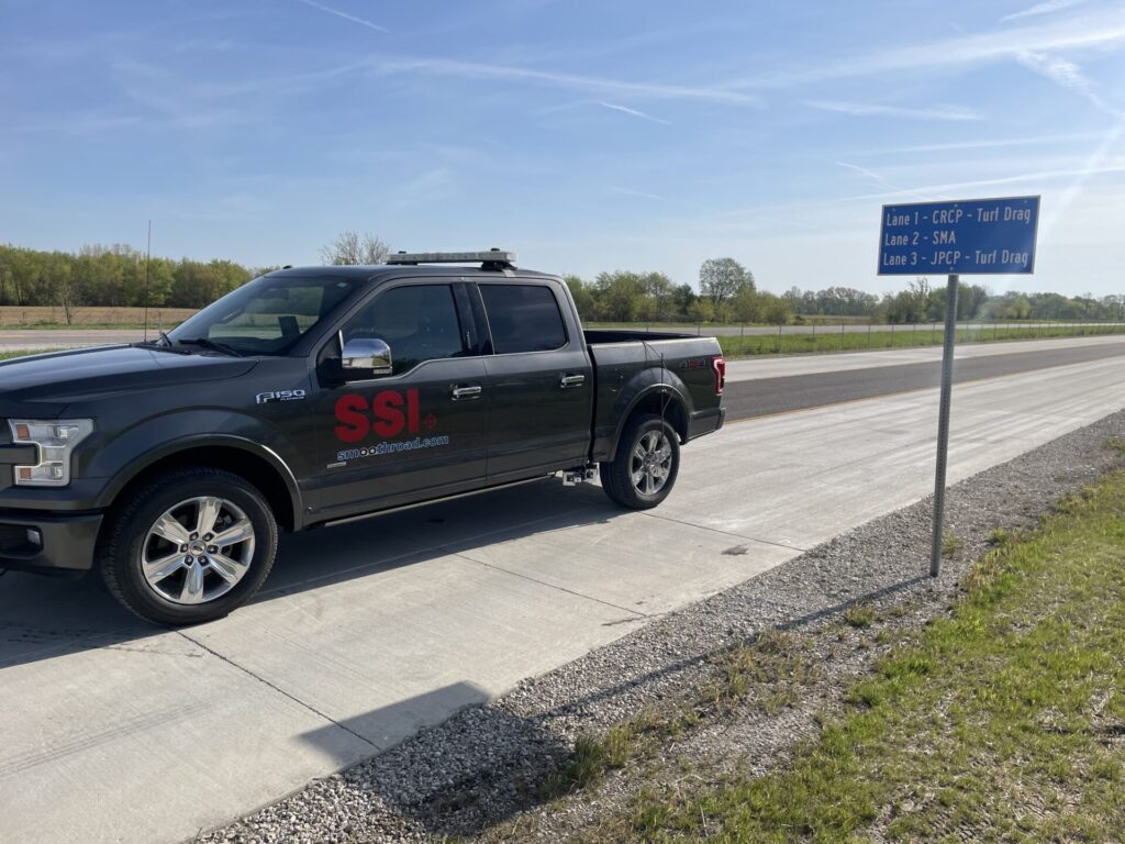
Inertial profiling systems generate 2D surface profiles under industry standards such as ASTM E950 and AASHTO r57. They record the wheelpath elevation profiles that affect the ride quality of the traveling public.
Inertial profiling systems are known for their accuracy, repeatability, and the overall ability to precisely measure features on the surface. New advancements in sensor technology have allowed current inertial profilers to also collect texture, ROW images, rutting, cross-slope, and 3D survey elevations for machine control systems. All inertial profiler data can be collected without traffic control at highway speeds.
At G3 Quality, we rely on our partners at SSI to provide us with inertial profiling systems that exceed our project needs. We’ve broken down how the different components of an inertial profiling system are utilized to ensure pavement smoothness:
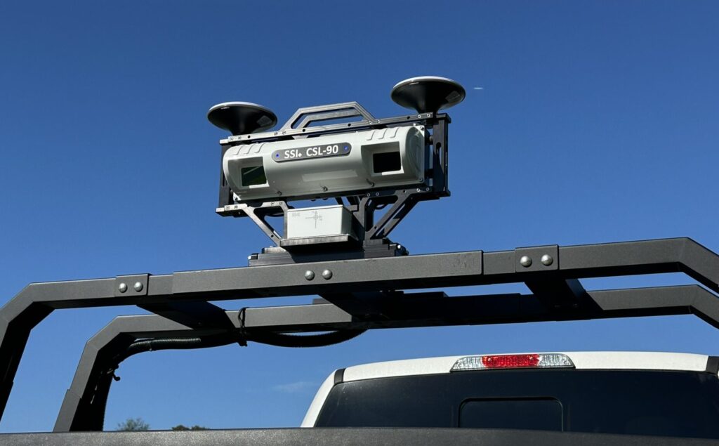
Laser Height Sensor
The purpose of a height sensor is to record the distance between the pavement surface and the host vehicle. The vertical measurements are usually acquired by one or multiple non-contact laser sensors. Typical sensors use a 4-inch wide beam laser to average out pavement texture from high void HMA mix designs or concrete tining. Each inertial profiler wheelpath laser must retain accuracy of 0.01-inches to comply with AASHTO r56.
Accelerometer
An accelerometer is paired with each wheelpath height sensor to cancel out the vertical motion of the host vehicle. The inertial profiler uses the on-board accelerometer to establish the inertial reference value, such as the relative height. SSI provides aerospace-grade accelerometer sensors rated for up to +/-5g or 10g, with a resolution to 0.0001g. The accelerometer is an important component that allows inertial profilers to be mounted and certified on a wide range of vehicles – from Smart cars and Segways to Ford F-350’s.
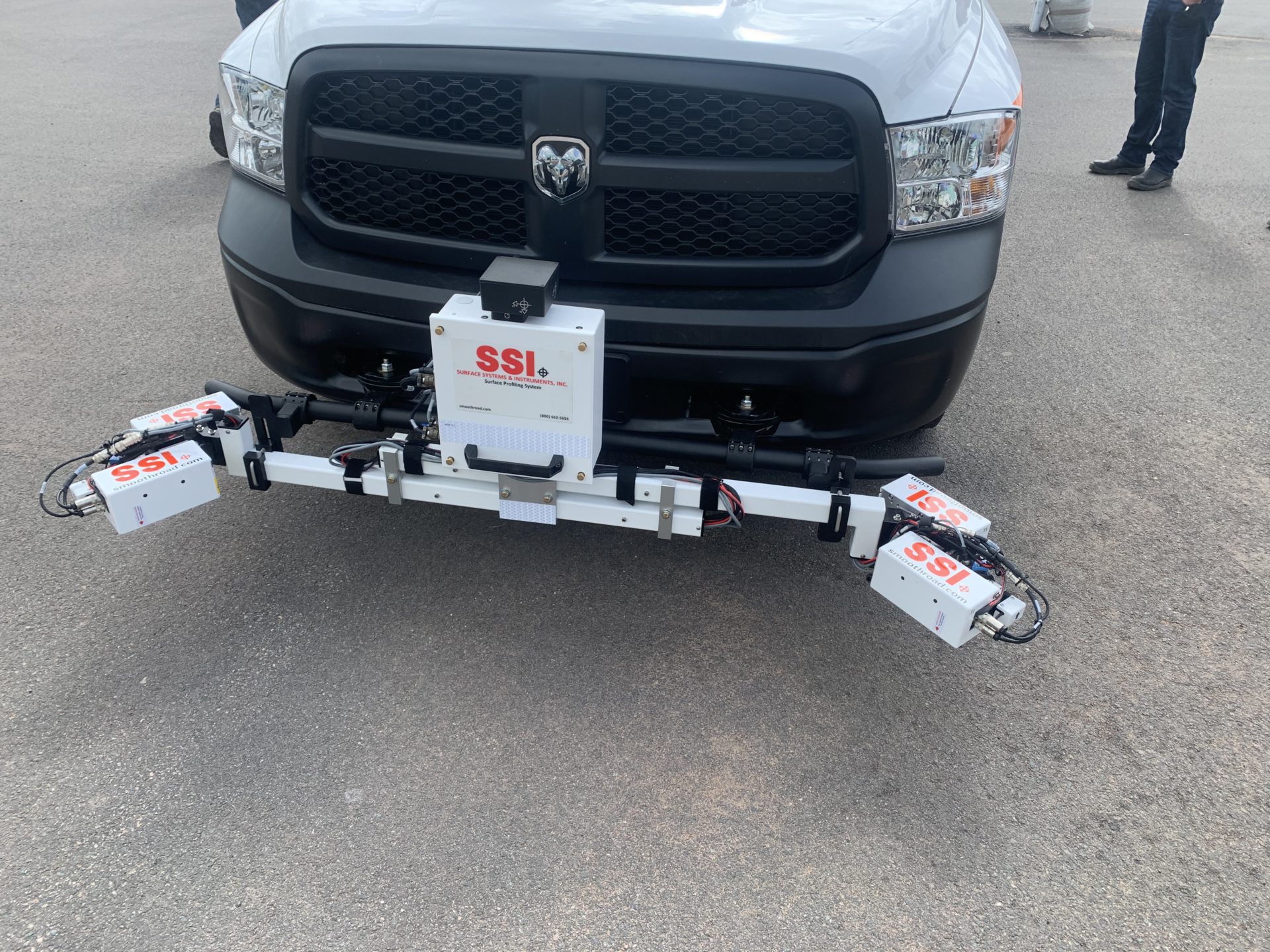
Distance Measurement Instrument
A Distance Measurement Instrument (DMI) is a transducer used to determine the longitudinal distance that the host vehicle has traveled. An inertial profiler captures an elevation sample from the accelerometer and height sensor for every 1-inch traveled. SSI now offers a GPS-DMI option which uses the accurate real-time position of the inertial profiler to govern data collection intervals.
Collection Procedure
The data gathered from the laser height sensor, accelerometer, and the DMI is used by the inertial profiler to produce the pavement profile. The International Roughness Index (IRI) is then calculated to summarize the impact of the pavement profile on vehicle response for a passenger car. The IRI is the world standard as the roughness measurement statistic of choice. Pavement smoothness specifications are centered around the wheelpath IRI values.
Inertial profilers must collect data above a minimum speed, usually 7 mph. The data collection will be started either through GPS coordinates, reflective cones marking the project limits, or manual entries. After the inertial profiler collects data within one project lane, the operator can use the inertial profiler analysis software or ProVal to calculate the IRI values.
Caltrans Inertial Profiler Specification
Caltrans inertial profiler collections follow CTM 387 and AASHTO r57. All inertial profiler systems and operators are verified on a DOT certification track per AASHTO r56. Operators and inertial profilers must renew their certification each year.
Caltrans specifies two metrics for acceptance; IRI Areas of Localized Roughness (IRI ALR) and the Mean Roughness Index (MRI). MRI is calculated as the average IRI for both wheelpaths over a 0.1-mile segment. In general, IRI ALR reports rapid changes in roughness such as headers, joints, and paver induced roughness. The MRI is the overall score for the lane.
The revised Caltrans smoothness specification introduced the pay adjustment spreadsheet along with other requirements. The Contractor and inertial profiler operator add the project information to the spreadsheet header for the Excel macros to determine the target smoothness requirements for the project. The pay adjustment spreadsheet will hold all collected data under each smoothness phase (Exist, Baseline, Pave, Final). It is important for the stationing of all smoothness phase data to match within specified tolerances.

The SSI Profiler profile viewing window
Caltrans projects promote the use of the FHWA pavement profiler software ProVal. ProVal is a free pavement profile analysis tool which can be downloaded at roadprofile.com
Link to the original published article:
www.g3quality.com/how-inertial-profiling-systems-work-to-measure-and-specify-pavement-smoothness