SSI Network Manager for Cities and Counties
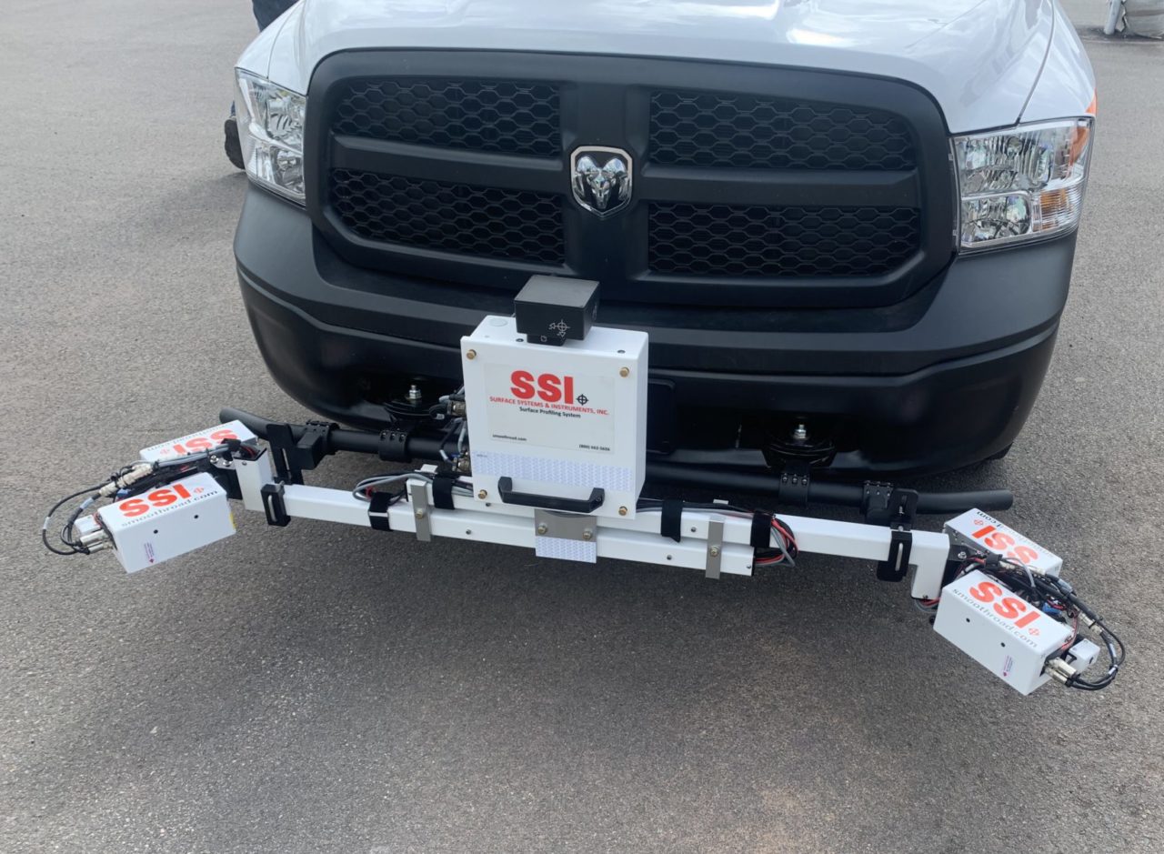
Rate and Track Network Pavement Condition Data With an SSI Zero-Speed Inertial Profiler
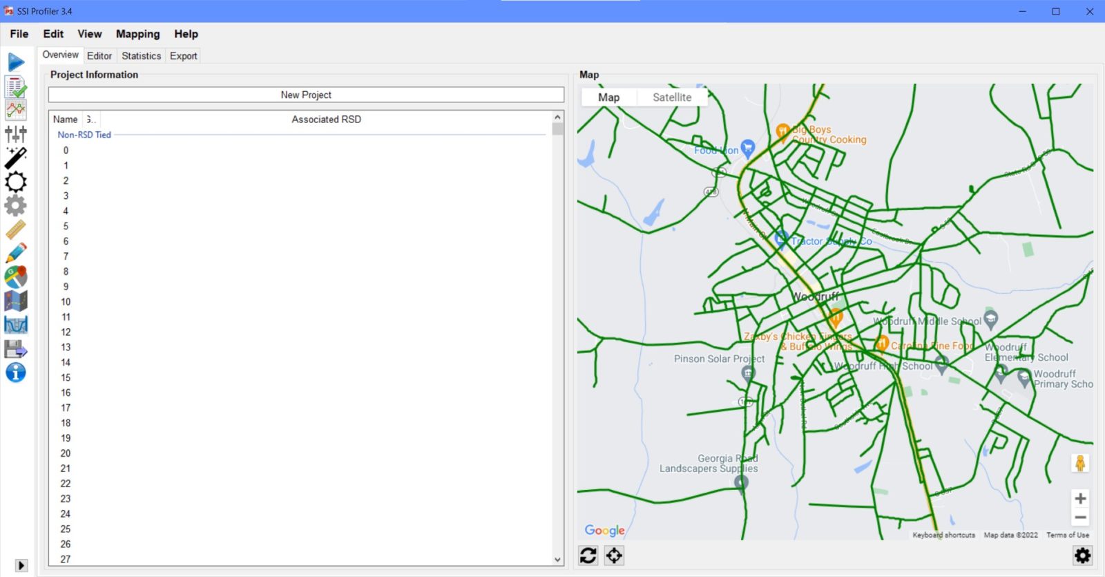
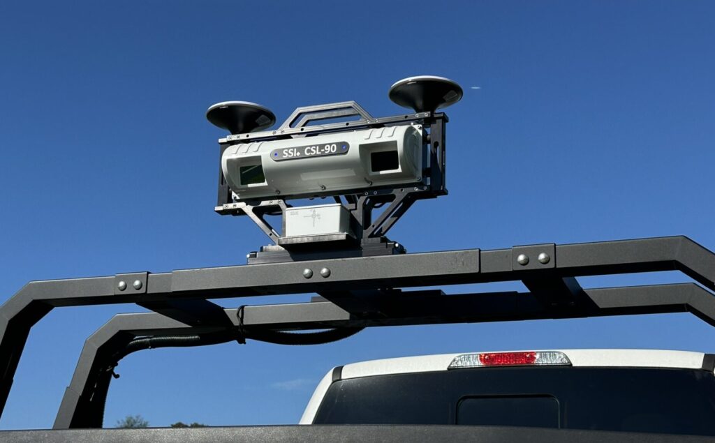
Most pavement deterioration can be detected by wheelpath roughness. SSI has developed the Network Manager module which allows for cities, counties, and consultants to collect network pavement condition data. The Network Manager module is embedded within the SSI Profiler software and can be used with any SSI profiling system.
- Collect accurate data at low speeds and stoppages with a Zero-Speed upgrade
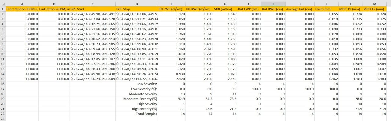
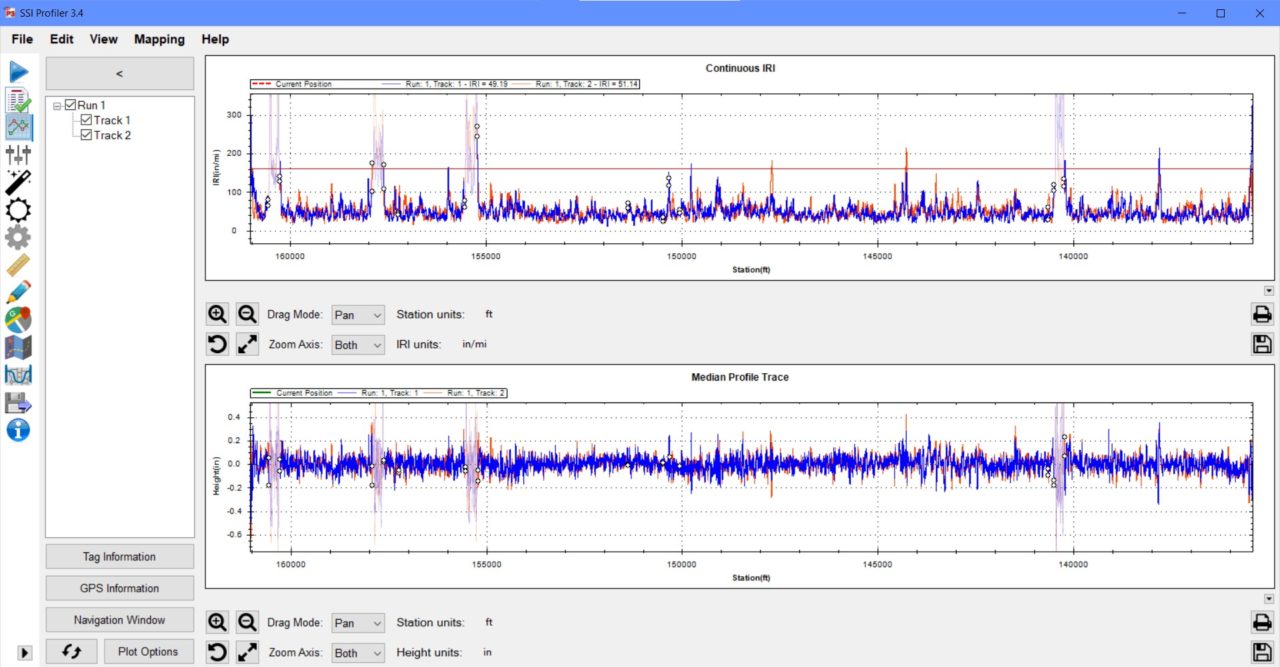
- Dual wheeltrack ride value reporting under ASTM E950 (IRI, MRI, PRI, HRI, RN, RMS available)
- GPS-DMI accurate within 0.05%
- PASER scale for visual pavement distress reporting
- Calculate a pavement rating from IRI, PASER scale, and other collected attributes
- Can collect transverse profiles for rutting. User selects sampling interval and reporting interval
- Modular options for ROW cameras, textures, IMU, cross-slope
The Network Manager does not output a PCI since the cracking or distress quantities are not being measured. The output is a rating scale that is relative for the entire pavement network and can be replicated over time. The system is designed to bridge the gap between cities and counties and expensive network surveys.
Starting the Process
The operator can import road centerline shapefiles or KMLs into SSI Profiler. Shapefiles will contain metadata and information that can be sorted to collect condition data in large batches, usually paths on the same street.
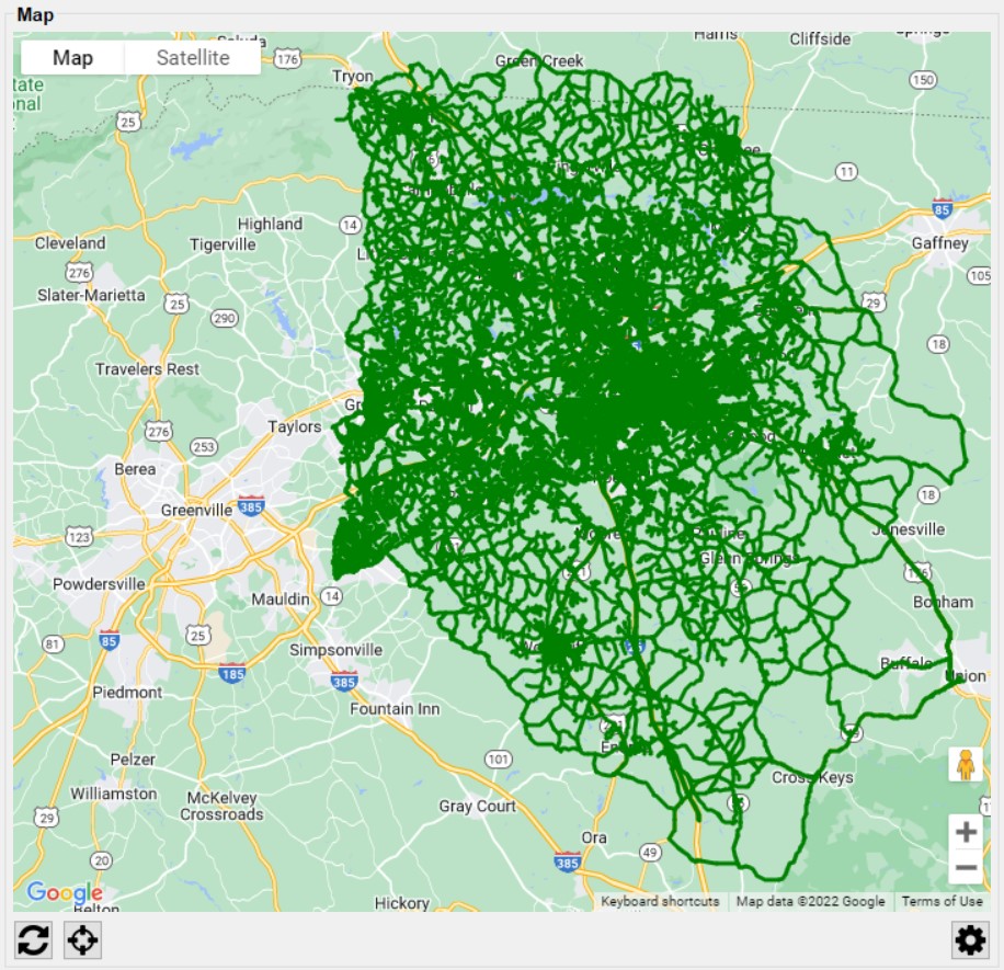
Start By Importing County Centerline Data Shapefile
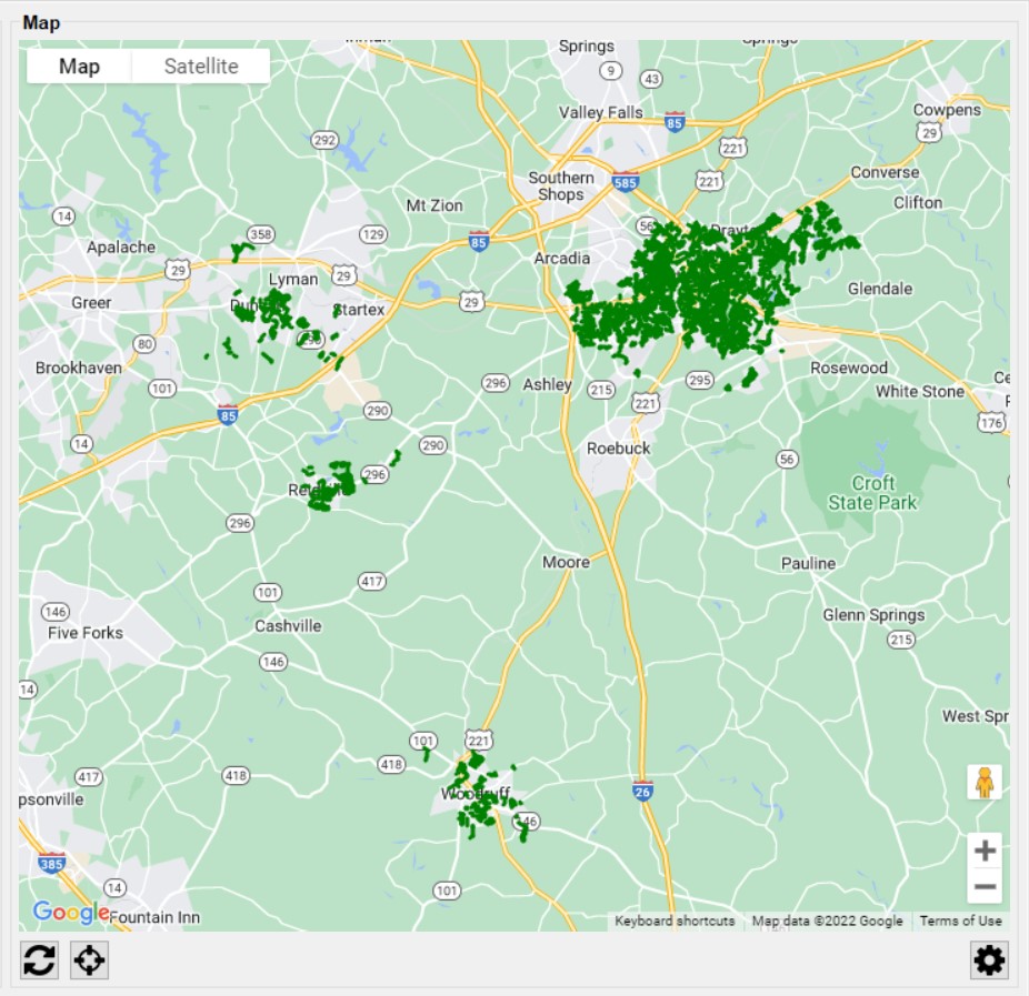
Sorting to Remove the County Roads and Undesired City Roads (from metadata information on maintenance responsibility)
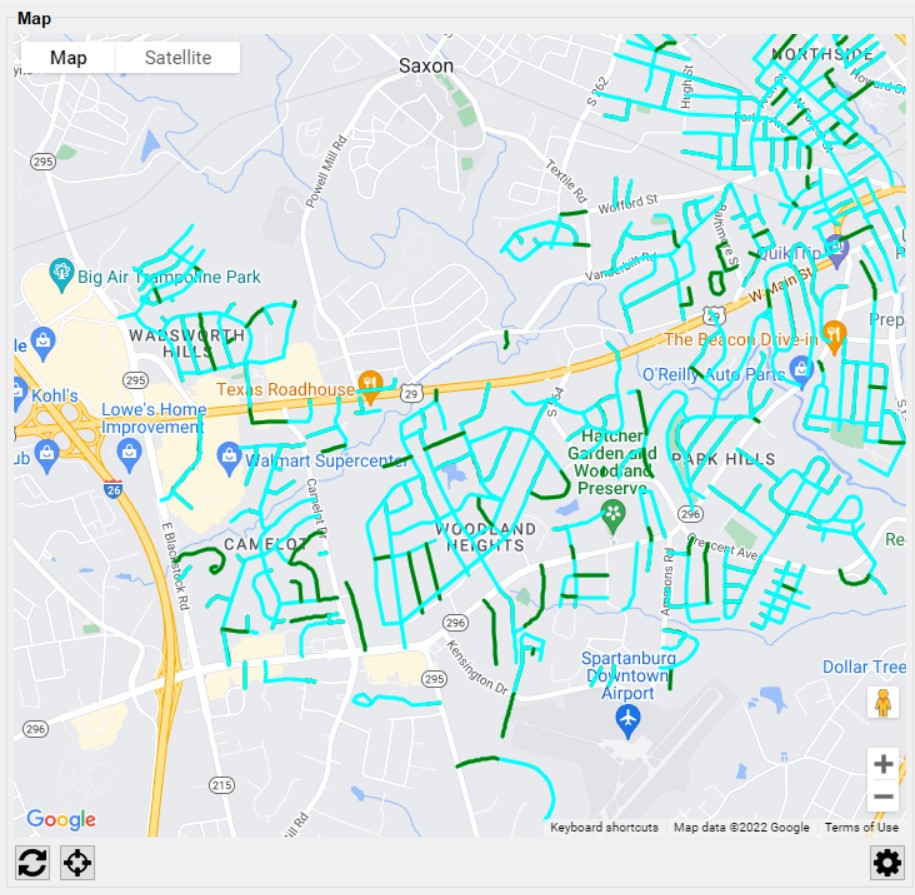
Grouping Paths By Street Name
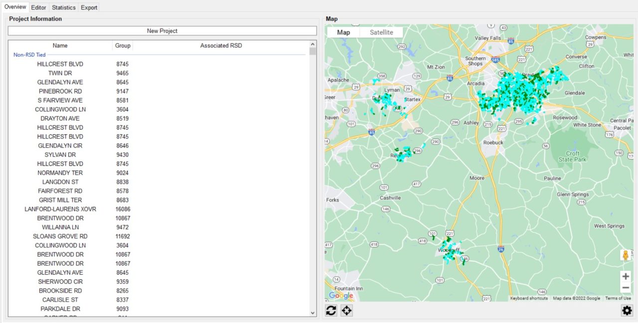
Grouped Paths in Teal
Collecting Data
While the roughness and laser data is being collected, the operator can visually rate the road in real time using the 1-10 PASER scale. The SSI collection program uses hot keys and settings to limit the operator’s time on the computer.
As the vehicle collects data, the network’s segments are triggered and sorted within the program by the GPS coordinates given in the shapefile or KML. This allows for data to be viewed or exported immediately after a collection. As the data is collected the collected segments start populating with data. The profiling system is easy to operate and can be learned in less than 4-hours.
What About Stopping?
A long time issue with data collection in urban areas has been low speeds or stopping because of red lights or traffic. With SSI’s Zero-Speed inertial profiler, data can be collected without additional error in low speeds and traffic. The error that occurs at low speeds has negatively affected condition data results when not using a Zero-Speed profiler. Most profiler systems introduce significant error when traveling less than 10 mph.
What to Do With the Collected Data?
Network Manager combines options for IRI, rutting, faulting, texture and visual pavement rating measurements. By not using a crack measurement sensor the cost of equipment and processing time is drastically reduced. Typically a Zero-Speed inertial profiler is used in conjunction with the data desired to be collected, like rutting. Data can be exported by the segment ID or by station with the attributes desired to determine a pavement condition score. The data exports from SSI Profiler can be imported into common GIS platforms like Cartegraph and ArcGIS. Typical exports for SSI Profiler are shapefiles or CSVs.
The results of the data can also be viewed within SSI Profiler or FHWA ProVal.